Recovering the past, one layer at a time.
|
Excavation of the Structure
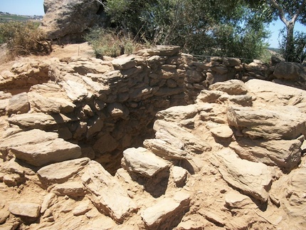
The 2010-2013, and 2017 fieldwork seasons at Caladinho build on previous recording of small forts and tower enclosures in the Alto Alentejo region. Caladinho is the first example of one of these small, fortified, rural structures to be systematically excavated in the Alentejo region. As such, the primary goal of this project is the identification of the inhabitants, the chronology of the site's occupation, and its place within the larger region. In addition to open area excavation of the main structure, targeted test pits around the hilltop will potentially reveal the extent of the occupation at Caladinho. Results from the 2010-2012 field seasons were reported at past Annual Meetings of the Archaeological Institute of America, and a preliminary report of the 2011 season was published in the journal Chronika. |
Regional Responses to Ancient Colonization
Given that many similar structures dot the Alentejan landscape, Caladinho's position within the larger regional context is quite important to its interpretation. These small, fortified structures appear at the moment of the colonial encounter between Romans and indigenous Lusitanians. Large-scale survey of the Alentejo, undertaken in response to the building of the Alqueva Dam, has revealed numerous archaeological sites which, when considered together, paint a picture of indigenous resistance, imperial acquisition, and a complex negotiation of territorial and ideological boundaries. By contextualizing Caladinho as part of a larger, regional response to colonial action, we hope to shed light on the processes, responses, and entanglements which resulted from the Roman reorganization of this region.
Given that many similar structures dot the Alentejan landscape, Caladinho's position within the larger regional context is quite important to its interpretation. These small, fortified structures appear at the moment of the colonial encounter between Romans and indigenous Lusitanians. Large-scale survey of the Alentejo, undertaken in response to the building of the Alqueva Dam, has revealed numerous archaeological sites which, when considered together, paint a picture of indigenous resistance, imperial acquisition, and a complex negotiation of territorial and ideological boundaries. By contextualizing Caladinho as part of a larger, regional response to colonial action, we hope to shed light on the processes, responses, and entanglements which resulted from the Roman reorganization of this region.
|
GIS Analysis and Surveillance
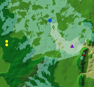
Caladinho's location affords it a superlative view of the surrounding countryside, and the other structures of this type are similarly positioned within the landscape. Analysis of these structures via Geographic Information Systems (GIS) modeling suggests that surveillance played an important role in determining the location of many of these structures. Our work seeks to re-theorize surveillance and surveillance structures in the archaeological record in order to better understand surveilled landscapes in a colonial context. Through viewshed analyze of Caladinho and many other sites in the region, we are creating a model of a colonial environment in which "watching" and "being watched" are categories embedded in the landscape. This data and analysis suggests a new way to understand how control over trade routes, population centers, and natural resources was gained and maintained in this and other regions. |
